GIS-based interactive maps on Hong Kong during the Second World War
Project Websites
- https://digital.lib.hkbu.edu.hk/japanese_occupation_of_hongkong/
- https://digital.lib.hkbu.edu.hk/1941hkbattle/en/index.php
Project Description
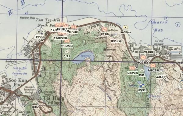
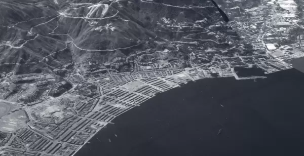
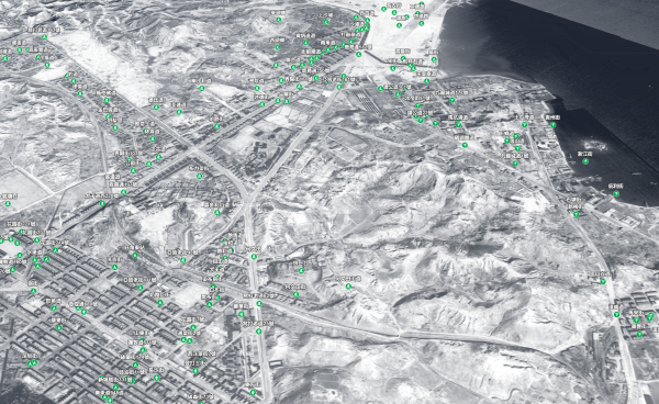
The "GIS-based Interactive Maps on Hong Kong during the Second World War" consists of two projects that deal with the experience of Hong Kong during the Second World War, using GIS-based interactive maps. It looks at not only the Japanese invasion of Hong Kong in December 1941 but also the occupation experience, showcasing Hong Kong's military, governance, economic, and civilian experiences during the Japanese Occupation that lasted from December 1941 to August 1945, an important episode to Hong Kong history that is often overlooked.
Combining historical research and geospatial technologies, Artificial Intelligence in data processing, and other digital humanities methods, the interactive maps of the project reconstruct the urban space of Hong Kong during the 1940s, allowing researchers and readers to understand various events and trends in their specific spatial context. The project aims to offer insights not only into the research of the topic but also to provide a useful and intuitive database for education, conservation, planning, and creative media.
Project Investigator
Professor KWONG Chi Man (Academy of Chinese, History, Religion and Philosophy)
Project Collaborator
Professor LAI Wai-lok (Department of Land Surveying and Geo-Informatics, Hong Kong Polytechnic University)
Funding/Award
- Digital Humanities Awards - DH Awards 2021 (Best DH Data Visualization: The Battle of Hong Kong 1941: A Spatial History Project https://digital.lib.hkbu.edu.hk/1941hkbattle/en/)
Publications
- Kwong, Chi Man. “Reappraising the Battle of Hong Kong: Preliminary Observations from a Spatial History Project.” Canadian Military History 30, no. 2 (2021): 1-37. https://scholars.wlu.ca/cmh/vol30/iss2/1/
- Kwong, Chi Man, Wallace W. L. Lai, and Michael B. C. Rivera. “Showcasing, Contextualizing, and Explaining the Diversity of Human Experiences in Combat Using Gis: The Battle of Hong Kong in 1941 as an Example.” International Journal of Military History and Historiography, September 2, 2024. https://doi.org/10.1163/24683302-bja10067.
- Sit, Kathleen Fei-Ching, Chun-Ho Pun, Wallace W L Lai, Dexter Kin-Wang Chung, and Chi-Man Kwong. “Unfolding WWII Heritages with Airborne and Ground-Based Laser Scanning.” Heritage, no. 6 (2023): 6189–6212. https://www.mdpi.com/2571-9408/6/9/325