

History unfolded: Professor Kwong Chi-man combines AI and spatial technologies to uncover a WWII mass grave
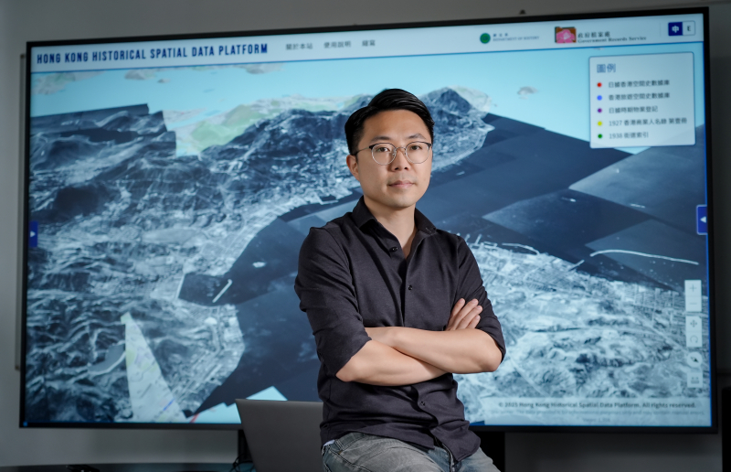
Beneath the bustling football pitch of King George V Memorial Park in Sai Ying Pun, a forgotten chapter of Hong Kong’s World War II history lay buried for decades. Uncovering this past was not achieved by traditional archaeological excavation, but through a combination of Artificial Intelligence (AI), Geographic Information Systems (GIS), and old aerial photographs.
For Professor Kwong Chi-man of the Academy of Chinese, History, Religion and Philosophy, Faculty of Arts and Social Sciences , the discovery of this WWII-era mass grave perfectly illustrates the formidable power of Digital Humanities—an emerging field that marries traditional archival research with cutting-edge technology.
“For years, digital humanities has frequently faced a certain criticism,” the professor explained. “Peers would question whether expensive digital technologies were simply being used to prove well-known common sense. However, we hope to demonstrate that these spatial histories can reveal historical trajectories that have been overlooked in the past.”
The discovery of the mass grave in King George V Memorial Park is akin to assembling a historical puzzle that spans many years. The story began with an oral history interview, during which an elderly resident pointed to a map and casually mentioned that a mass grave once existed within the park. Years later, while processing another elder’s memoir manuscript using AI, Professor Kwong’s team found a corroborating account.
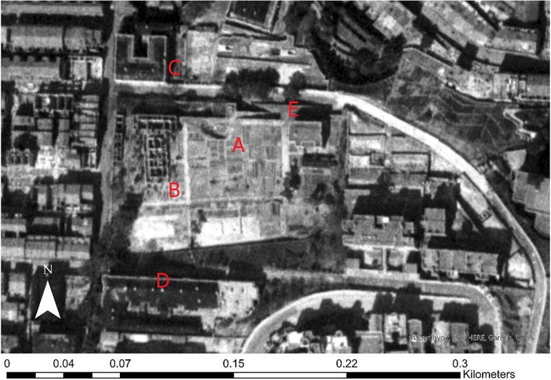
The OGCH playground; photograph taken on 2 February 1945. A: the pit for the mass grave and the nearby long pits dug between December 1941 and January 1942; B: the half-demolished quarters; C: Sai Ying Pun Hospital; D: the Mental Hospital; E: the ramp for carts going up to the playground/mass grave (Department of History, Hong Kong Baptist University). Source: National Archives and Records Administration (NARA).
The breakthrough occurred in 2023, when the team obtained a historical aerial photograph from the United States. Through spatial georeferencing, they could drape this 2D photograph accurately over a modern 3D Digital Terrain Model (DTM) of Hong Kong. “Because the alignment was highly precise, we were able to determine the exact site of that burial pit at the time—right at the corner of today’s football pitch,” Professor Kwong said.
To further confirm this, his team collaborated with The Hong Kong Polytechnic University to scan the area using Ground Penetrating Radar (GPR). Beneath the concrete, the radar did indeed detect a massive, backfilled pit.
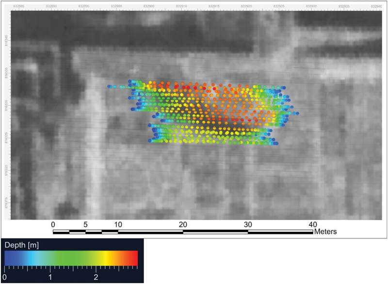
Color-coded 2.5D underground crater terrain model of the suspected mass burial pit at KGV Park (Department of Land Surveying and Geospatial Science, the Hong Kong Polytechnic University)
.jpg)
3D model of the suspected mass burial pit at KGV Park (Department of Land Surveying and Geospatial Science, the Hong Kong Polytechnic University)
Traditional archival research filled in the heavy historical context. Files showed that over 2,400 human remains were exhumed and registered after the war, neatly arranged in closely spaced trenches. However, there were no burial records for this specific pit. It was a temporary mass grave from the Japanese occupation era, used to bury people who had starved to death on the streets.
By conducting a spatial cross-comparison of the pit’s location with the capacity of hospitals and the whereabouts of rice shops at the time, Professor Kwong’s team reported a cruel reality. The wealthy in the Mid-Levels did not need to queue as food supplies were delivered directly to them, whereas the impoverished masses—primarily coolies and single men living near the piers and warehouses—were on the brink of starvation. Dying unclaimed, they were just thrown into this unmarked pit.
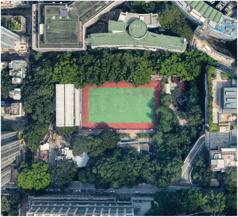
The King George V Memorial Parkin 2025
“What this paper ultimately explores is the spatial inequality of life and death in Hong Kong during the Japanese occupation,” Professor Kwong pointed out. “It accurately delineates the backgrounds of the victims and their burial sites.”
Building a Time Machine: AI, GPUs, and the “Oil Lamp” System
To conduct analysis with such high precision, historians require massive amounts of data. However, the professor highlighted a glaring paradox in local historical research: “Globally, Hong Kong is one of the cities with the most documented materials, yet its degree of digitisation remains at a relatively low level in Asia.”
To process voluminous written texts, street indices, and business directories, Professor Kwong’s team developed an Optical Character Recognition (OCR) platform, they named “Yaudang” (Cantonese for “Oil Lamp”). Because commercial cloud AI models often produce errors when handling complex bilingual English-Chinese historical layouts, and due to data security considerations, the team spent a grant from the university’s Research Office (RO) on their own powerful GPU server.
This local computing power enables them to train open-source models to read century-old records minutely, so that when AI scans a historical Hong Kong Street Index, phone book, or business directory, it not only reads the text but also extracts tabular data and performs geolocation.
“We are essentially transforming black-and-white historical spatial data into individual data points on a map,” the professor observed.
For instance, by digitising the 1938 Street Index, the team can find historical addresses that no longer exist. Today, if someone searches an online map for a 1930s address that has since been demolished, the system often yields skewed results, however Professor Kwong’s database can anchor that vanished address to its corresponding modern latitude and longitude correctly.
A Century of Tourism: Making History Interactive
While war and social inequality feature prominently in his research, Professor Kwong also applies technology to exploring more appealing cultural history. Supported by a HK$1.3 million grant from the Curriculum Development Institute, Education Bureau, his team is set to launch “A Century of Tourism in Hong Kong,” an interactive map platform covering the development of tourism in Hong Kong from 1880 to the 1980s.
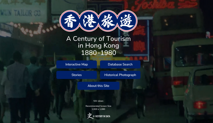
This project will serve as a historical online travel guide. By scanning travel publications from various eras, the team has recreated the exact routes of past tourists on the map.
“We integrated the contents of a 1941 travel book titled Great Hong Kong directly into our map platform,” Professor Kwong explained. “Each colour on the map represents a specific route, and shows clearly how guides recommended touring Hong Kong, and the notable attractions along the way.”
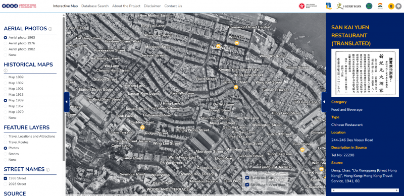
The map enriches what Professor Kwong terms “contextual history”. It features old advertisements, historical photos of demolished hotels, and the footprint of famous visitors such as Rabindranath Tagore, Albert Einstein, and Eileen Chang. It even recounts anecdotes, such as South Korean actress Choi Eun-hee being kidnapped on Repulse Bay Beach, and marks them vividly so users can zoom in to see the exact location.
Bridging the Divide Between Humanities and Technology
Transforming a traditional history department into a high-tech data laboratory requires a monumental shift in mindset. Professor Kwong recalls that over a decade ago while pursuing his Ph.D. in East Asian history in the UK, he still had to draw flat maps lacking topographical features by hand. Facing the wave of digitisation, he too has gone through a continuous learning process.
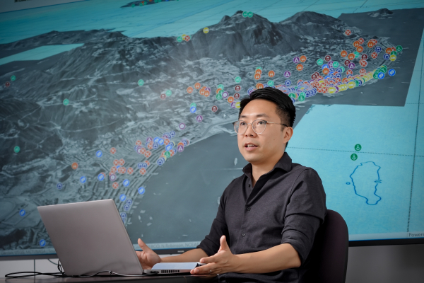
“The guiding principle: researchers must be hands-on,” he advises humanities scholars interested in integrating technology. “You don’t need to develop every tool from scratch on your own, but you must practise using it yourselves. If you delegate all the technical work, you won’t understand the limitations in the process, nor will you discover new research directions that the data might bring.”
Currently, his team comprises six to eight members, operating more like a tech startup than a traditional humanities research group. It includes web developers, GIS experts, and a research manager acting as a bridge between historical content and technical execution.
The team is actively training humanities students in programming skills. “With the popularisation of vibe coding over the past year or two, our humanities students have become quite proficient in coding and have contributed in a unique way,” the professor said proudly. HKBU has now introduced courses such as Spatial History and AI-Assisted Historical Data Processing, teaching the new generation of historians how to use tools like the “Oil Lamp” to handle massive datasets.
The Value of Historical Verification to Modern Society
To Professor Kwong, the digitisation of history is more than just academic research: it embodies immense social and economic value.
Hong Kong is one of the cities with the most documented materials, yet its degree of digitisation remains at a relatively low level in Asia.
Professor Kwong Chi-man
Academy of Chinese, History, Religion and Philosophy
He specified that while everyone discusses AI technology at length today, Large Language Models (LLMs) like ChatGPT have an extremely limited knowledge of Hong Kong’s history because the original documents have not yet been comprehensively digitised. “If you try to discuss local history with an LLM, it simply has no starting point because it lacks the relevant data sources. Therefore, AI absolutely cannot replace our verification work at this stage.”
Factoring in a historical “dud rate” of about 10% to 20%, the team used historical archives and GIS to estimate that a certain number of unexploded bombs may still be buried beneath densely populated parts of Hong Kong. They also helped analyse the significance of the wartime bomb found in Taikoo in 2025.
Since this major project, funded by the Research Impact Fund (RIF), is progressing smoothly, the team is focused on completing a digital map covering Hong Kong Island and Kowloon, which it plans to extend to the New Territories. Professor Kwong’s research blueprint is continually expanding.
Professor Kwong’s research profile: Chi Man KWONG - Hong Kong Baptist University